Flying over the Vltava: from the Dancing House to Vyšehrad
When a client needs aerial footage from one of Prague’s most heavily regulated areas, image quality is not the only consideration. The key is to take on the regulatory, safety, and organisational burden and deliver precise footage.
The brief
The client hired me to capture real aerial footage. My role was to deliver compositionally and positionally precise shots for subsequent presentation.
Location
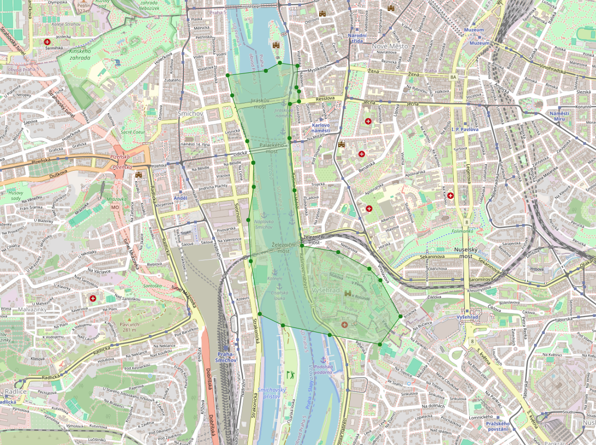
The flights took place above and around the Vltava, in a corridor extending from the Dancing House to Vyšehrad. Within this compact area, the protection zone of a heliport overlaps with a railway bridge and locations where daytime drone operation is effectively impossible because of crowds.
Why flying in central Prague is difficult
The rules in this area are stricter and more complex than in many zones around airports because several restrictions overlap. Without careful mapping and approval from the relevant authorities, the operation would be neither legal nor safe.
Preparation and permits
The first step was to determine what could be done without individual permission and what required approval across the C0, C1, and C2 drone categories. The dronemap.gov.cz portal provided the working overview of geographical zones and operating conditions.
I first contacted the heliport operator, the Ministry of Health, submitted the flight plan, and obtained approval under precisely defined conditions. Permission from the Railway Administration followed because of the proximity to the Vyšehrad railway bridge.

Flight conditions
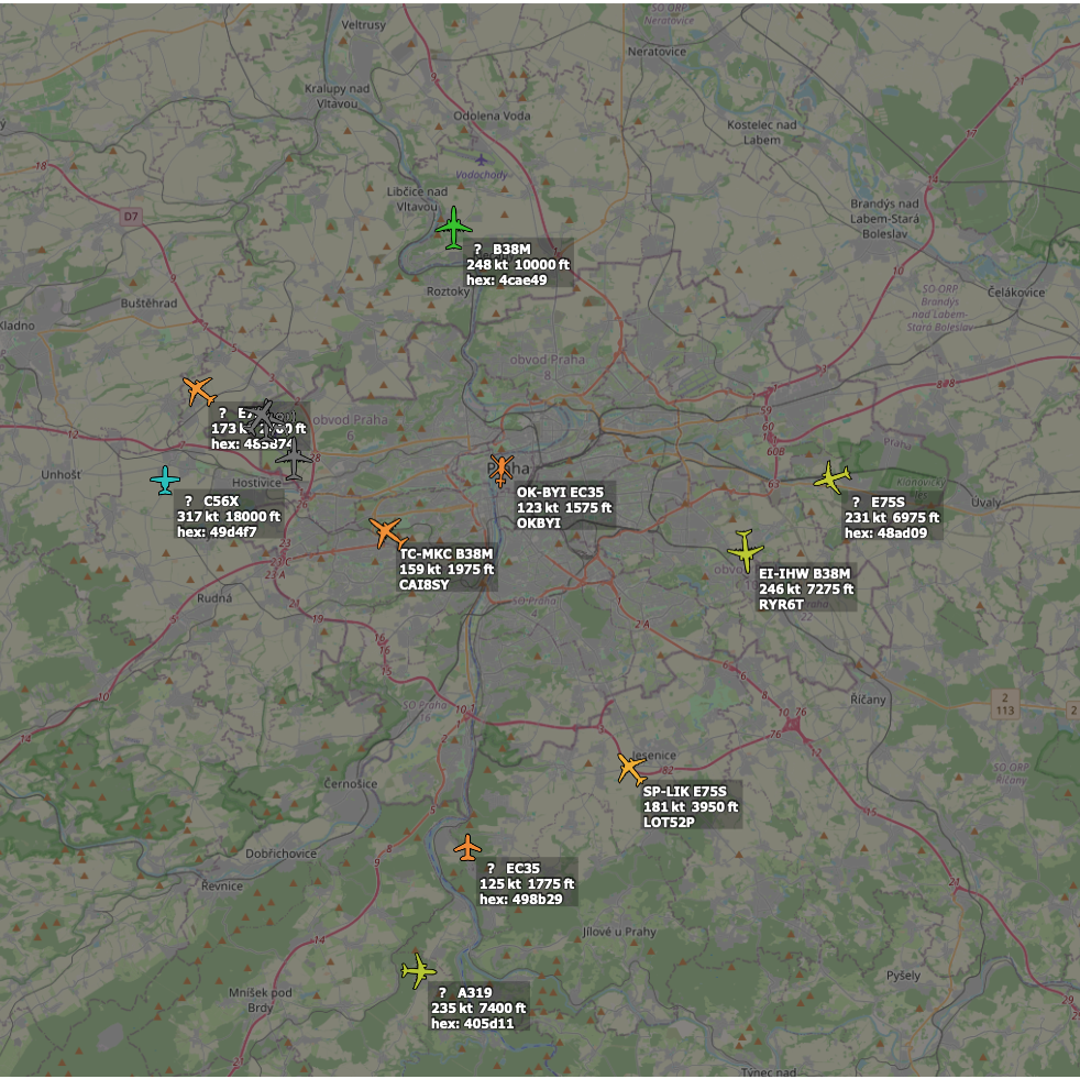
The operation was only possible with continuous coordination with the heliport operator, at a pre-approved altitude, and with constant ADS-B radar monitoring. If a helicopter approached, the drone had to land immediately.
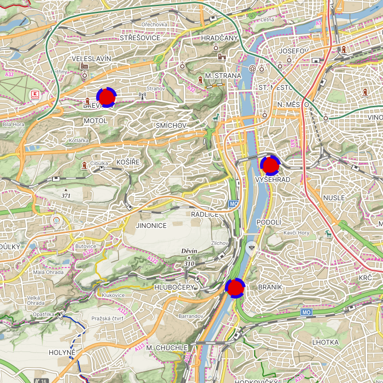
At the same time, three spotters were positioned at Vyšehrad, near Barrandov Bridge, and in Tomanova Street. They monitored the airspace by radio and confirmed in real time whether the flight could continue.
Timing
Some locations, such as Jirásek Square, are crowded during the day. Flights therefore had to take place at around four in the morning, when the area was almost free of pedestrians, cars, and public transport. The same applied to Vyšehrad.
Afternoon flights were not an option. Daylight, dawn, and night footage was therefore created in precisely planned time windows according to what each location allowed.
The team
There were six of us in total. I worked at the key and most demanding location at Vyšehrad, capturing night, dawn, and daytime footage. Three spotters provided safety supervision, while a two-person team handled a less exposed location below heliport level, where continuous coordination was no longer required.
Equipment
I captured most of the footage with a C2-category DJI Mavic 4 Pro because of its image quality and range of lenses. I used a smaller C0-category drone only where the C2 could not be deployed, specifically for one daytime shot near Jirásek Square.
Live operation
Trains crossed the Vyšehrad bridge frequently, so I repeatedly moved the drone to a safe distance and waited for a clear shot. No approaching helicopter was reported during filming, but the entire safety system remained ready to respond immediately.
Result
The finished footage fulfilled its purpose. The commission showed that piloting itself is not the hardest part of aerial work in central Prague. What matters most is the ability to arrange the permits, coordinate the safety team, and take responsibility for the entire process.
Acknowledgements
I would also like to thank my entire team, who had to get up with me at three in the morning and spend several hours watching the sky, as well as the client, who trusted me throughout the project. I also thank the HEMS coordinator for permission and coordination, Air Navigation Services of the Czech Republic and the Civil Aviation Authority for their consultations, and the director of the Railway Administration’s Safety and Crisis Management Department.
Photographer and drone pilot Jiří Bednář